- Visit Hvolsvöllur
- Residents
- Administration
- Living in Rangárþing eystra
- Íslenska
Hiking Trail
Discover the Scenic Hiking Trails in Rangárþing eystra:
-
Hvolsfjall Trail:
- Distance: 2 km
- Elevation: 127 m
- Walking Time: 1 hour
- Hiking Details: Hvolsfjall, a 127-meter high mountain at Hvolsvöllur, offers an easy climb suitable for families. Begin your journey from Bjalli near the Church, following a well-laid footpath. From the summit, the trail descends through the hill, passing steps and a forest. Connect with Nýbýlavegur for a complete experience.
-
Training Trail Hvolsvöllur:
- Distance: 4.2 km
- Elevation: Slight rise
- Walking Time: 1-2 hours
- Hiking Details: A popular trail leading from Nýbýlvegur to Akur, offering diverse routes. Wander along the hedge to the new cemetery or continue to Lynghaga and Sólheimir, passing the riding arena and trails in Miðalda. Various lengths and difficulty levels cater to different preferences.
-
Tumstaðir Trail:
- Distance: Varies
- Elevation: Small
- Walking Time: Flexible
- Hiking Details: Tunguskógur and Tumastaðir in Fljótshlíð, 9 km from Hvolsvöllur, provide a serene outdoor space. Wander through woodlands, follow laid footpaths, and enjoy the environment with tables and benches. Paths of different lengths allow you to explore the beauty cultivated by locals.
-
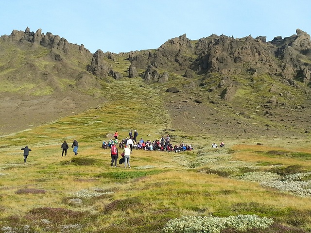
A Þríhyrningur Trail:
- Distance: 7 km
- Elevation: 500 meters
- Walking Time: 3 hours
- Hiking Details: Þríhyrningur, 18 km from Hvolsvelli, promises stunning views. Drive to Tumastaðir, then walk from Fiská up the mountain to the southwest. Explore Vatnsdal Cave nearby. The Þríhyrningur peak offers panoramic views, and the name relates to its three corners and the valley Flosadalur from Njáls saga.
-
Þórólfsfell Trail:
- Distance: 6.5 km
- Elevation: 500 meters
- Walking Time: 4-5 hours
- Hiking Details: Þórólfsfell, a 574-meter tuff rock, offers breathtaking views of Tindjallajökull, Eyjafjallajökull, and Mýrdalsjökul glaciers. Start from Fell and walk along the river into Þórólfsgljúfrid, then ascend the rocky ridge. A detour to Mögugil reveals impressive tuff formations and a unique natural phenomenon, Mögugilshelli cave.
-
Stora – Dimon Trail:
- Distance: 1 km
- Elevation: 178
- Walking Time: 1 hour
- Directions: Take Dímonarveg (250) from Highway 1 toward Víkur from Hvolsvöllur. Stóra-Dímon, at the meeting point of Austur Landey, Fljótshlíðar, and Vestur Eyjafjalla, offers a short, picturesque hike. Discover the history of Huskarl battles from Njáls saga at Sögusetrin near the mountain's base.